What is a Tornado Emergency?

Table of Contents
Tornado Warning. Tornado Emergency. You’ll get both of them via an NOAA Weather Radio, but there IS an important difference.
A Tornado Warning is issued when there is a tornado happening right now or expected very soon. Take shelter.
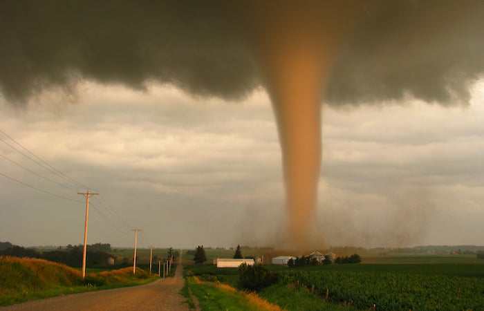
A Tornado Emergency is issued when there is a verified, strong, damaging tornado currently on the ground and moving toward you. So, it’s basically a Tornado Warning on steroids. If you’re not already in your shelter, get there immediately.
Tornado Emergency vs. Tornado Warning
A Tornado Warning is issued when a tornado has been sighted, or a tornado is possible. That “possible” word means conditions are favorable for a tornado to form, but perhaps it hasn’t spun up yet. Still, when a Tornado Warning is issued, it could also mean there IS a tornado on the ground. Either way, when the warning is issued, take cover immediately.
Meteorologists try to control their FAR (false alarm ratio) so as not to be accused of crying wolf. Truth be told, quite a few tornado warnings are never verified with a real tornado, leading some people to become complacent. A Tornado Warning was issued, but no tornado ever formed—yawn.
The First Tornado Emergency Alert
A Tornado Emergency cuts through any sense of complacency to announce, “this is real, and it’s very dangerous.” The first-ever Tornado Emergency was issued by the National Weather Service in Norman, Oklahoma on May 3, 1999 as the Bridge Creek-Moore F-5 tornado headed toward the Oklahoma City metro area. A tornado warning was already in effect, but meteorologist Dave Andra composed a new, more strongly worded alert. Then forecaster Forrest Mitchell went “live” on NOAA Weather Radio to update listeners to a “Tornado Emergency”. The actual text of that alert can be found below.
SEVERE WEATHER STATEMENT NATIONAL WEATHER SERVICE NORMAN OK 657 PM CDT MON MAY 3 1999 ...TORNADO EMERGENCY IN SOUTH OKLAHOMA CITY METRO AREA... AT 657 PM CDT...A LARGE TORNADO WAS MOVING ALONG INTERSTATE 44 WEST OF NEWCASTLE. ON ITS PRESENT PATH...THIS LARGE DAMAGING TORNADO WILL ENTER SOUTHWEST SECTIONS OF THE OKLAHOMA CITY METRO AREA BETWEEN 715 PM AND 730 PM. PERSONS IN MOORE AND SOUTH OKLAHOMA CITY SHOULD TAKE IMMEDIATE TORNADO PRECAUTIONS THIS IS AN EXTREMELY DANGEROUS AND LIFE THREATENING SITUATION. IF YOU ARE IN THE PATH OF THIS LARGE AND DESTRUCTIVE TORNADO...TAKE COVER IMMEDIATELY. DOPPLER RADAR INDICATED THIS STORM MAY CONTAIN DESTRUCTIVE HAIL TO THE SIZE OF BASEBALLS...OR LARGER.
It was a good call on their part. The tornado went directly through Moore, southern Oklahoma City, Del City, and Tinker Air Force Base. Ultimately killing more than thirty people and causing a billion dollars in damage. A mobile research radar got close enough to the twister to measure a wind speed of more than 300 mph. That wind speed earned it the title of the strongest tornado ever to be so measured.
Tornado Emergency Alerts Save Lives
Tornado Emergency warnings were also issued for the devastating Greensburg, Kansas EF-5 tornado. As well as the Taylorville, Illinois EF-3 tornado, which struck the tiny town just minutes before their annual Christmas parade was to begin. That bulletin prevented a mass tragedy.
Tornado Emergency messages are rare, and are issued only when a confirmed, large, and dangerous tornado will be catastrophically impacting an area. These enhanced bulletins were generally preceded by a “standard” Tornado Warning. So, whichever message you receive, Tornado Warning or Tornado Emergency, take it seriously. Get to your shelter and stay there until the warning expires. And remember, the fastest, most direct way to get these warnings is by having a weather radio in your home, your school, and your business. NOAA Weather Radios save lives!


