Powerful Hurricane Ida Makes Landfall and Wreaks Havoc
August 29th is apparently an unlucky day for Louisiana.
Category 3 Hurricane Katrina made landfall in the Bayou State on August 29, 2005. It generated flooding that created the most expensive natural disaster in state history.
On August 29, 2021 Category 4* Hurricane Ida roared ashore, her wrath leaving a trail of destruction that will take many months to repair. An estimated one million people were without power and with some major feeder lines down. Restoring electricity will be a Herculean task.
A LOOK AT HURRICANE IDA
Although Ida was given a Category 4 designation due to winds of more than 140 mph, a ship docked near the landfall point clocked a sustained wind of 149 mph and a gust of 172 mph.
Should these readings be verified, Ida could be elevated to Category 5 status. That would make it one of only five Category 5’s to ever strike the US mainland. Either way, it was a big storm.
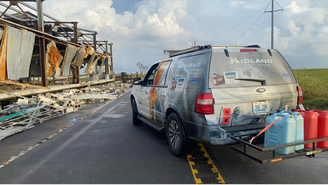
SevereStudios storm chasers Chris O’Neal and John Humphress documented the arrival and the aftermath of the frightening storm. Would you stick around for something like this?
HURRICANE SEASON AND HURRICANE IDA
The Atlantic Ocean’s hurricane season runs from June 1 to November 30, the period when ocean water temperatures are at their warmest. Hurricane Ida benefited from this warmth by passing across a particularly toasty spot in the middle of the Gulf of Mexico. The water was warmer than 86 degrees and extended more than 130 feet deep. That astounding amount of stored energy converted Ida from a Category 2 to a Category 4 in just half a day. It's a very rapid rate of intensification that may be related to our warming climate.
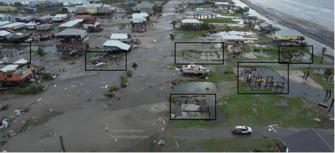
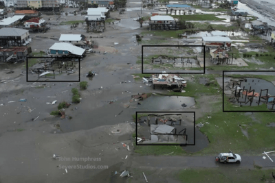
Shoreline effects of hurricanes are obvious. Chaser John Humphress took this photo and highlighted the stark empty piers that once held houses, all blown away by Ida. With winds blowing from right to left, you can see how the breakdown of one house can destroy the next house downwind by simply battering it to pieces with high-speed debris.
AFTER LANDFALL
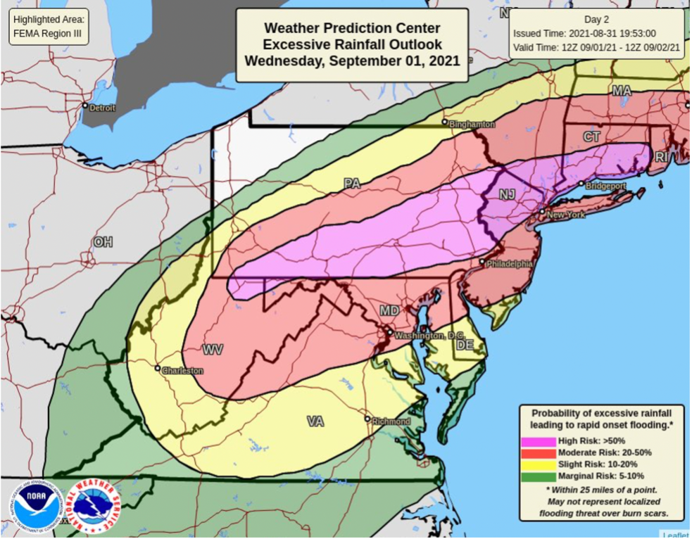
But after landfall, hurricanes create other forms of danger. Once inland, they are prolific producers of tornadoes, and their drenching rains create flash flooding that can be historic in its impact. Three full days after coming ashore in Louisiana, the remnants of Ida were 1,300 miles away threatening a “high risk” of flash flooding in New England.
STAYING ALERT
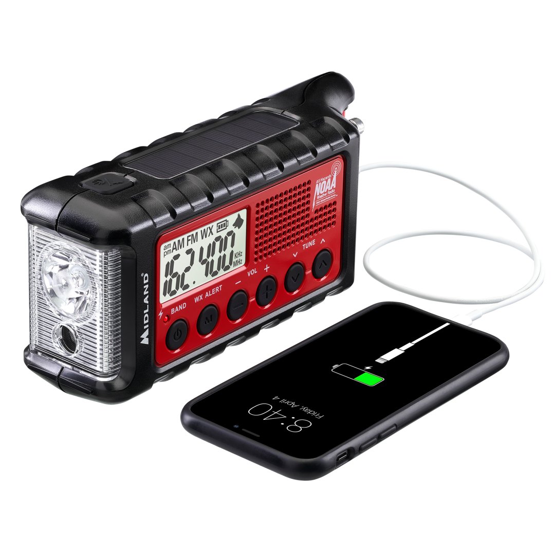
For recharging your phone during a prolonged power outage, receiving tornado or flood warnings, or just having a bright, reliable flashlight, the Midland ER-310 Emergency Hand Crank Radio should be in every home’s emergency kit. Providing AM/FM/NOAA Weather Radio reception in all kinds of weather, this reliable safety tool can help you survive whatever comes your way…even when your electricity is out.
NATIONAL PREPAREDNESS MONTH
Every September is National Preparedness Month because America has the worst weather on the planet.
We want families to anticipate possible trouble and put themselves in the position to be able to survive it. To take that first step, visit www.ready.gov for tips on how to start strengthening your family today.
Having a plan, building a kit, and being prepared for disasters makes you feel more confident and in control, knowing that if the worst thing happens, your family has a better chance of making it through.
Remember the old adage, “Those who fail to plan are planning to fail.” Start your plan today.
