Advance Warnings Prevent Deaths During Kansas City Tornado

Table of Contents
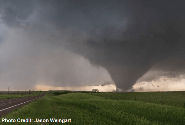
Midland Radio Corporation is headquartered in Kansas City, Missouri, in the heart of America's "Tornado Alley." We are used to having severe weather in the month of May, but the importance of having a NOAA Weather Radio was emphasized on May 28, 2019 when a large, destructive tornado touched down southwest of Lawrence, Kansas and tracked 32 miles toward the western suburbs of Kansas City. Homes and businesses were destroyed by this massive tornado, which was at times a mile wide, but luckily no one was killed.
Kansas City Tornado Watch Came Early
Outstanding work by the National Weather Service (NWS) allowed everyone to receive the situation-alerting Tornado Watch, and the subsequent life-saving Tornado Warnings. Early in the morning, the NWS office in Kansas City highlighted the day's risk of severe weather in their forecast discussion:
At 1:55 pm, more than four hours before the tornado touched down, the NWS Storm Prediction Center in Norman, Oklahoma issued Tornado Watch #275 that set off NOAA Weather Radios in the area, alerting everyone to the possibility of severe weather, including the potential for strong tornadoes:
Note the radar image at the time Tornado Watch #275 was issued: there were no thunderstorms present near Kansas City. Within the next several hours, this would change. It is important to remember: when a Tornado Watch is issued for your area, keep abreast of weather conditions and make sure wherever you go, you have one or more methods of receiving warnings and updates.
Kansas City Tornado Warning Came 24 Minutes Before Touchdown
The EF-4 tornado first developed around 6:05pm, with the NWS-Topeka Tornado Warning preceding the tornado touchdown by 24 minutes. That means people with a NOAA Weather Radio had almost a half-hour to prepare themselves for the storm's arrival. (Note...if you have a plan of action in your home, sixty seconds can be sufficient!)
At 6:11 pm NWS-Topeka issued a second Tornado Warning when Douglas County Emergency Management confirmed a tornado had touched down. A third, more strongly worded Tornado Emergency was issued for Lawrence and Eudora, as the twister roared closer:
"TORNADO EMERGENCY for southeast Lawrence and Eudora. This is a PARTICULARLY DANGEROUS SITUATION. TAKE COVER NOW!"
The strength and size of this mile-wide tornado is evident in this radar image, taken as the twister exited southeast Lawrence. The upper image is the radar showing the pattern of rain wrapping around the tornado. The yellow dot between Lawrence and Eudora is actually the "eye" of the tornado. Although hurricanes frequently have a visible "eye", only the largest and strongest tornadoes develop such a feature.
The lower image is the radar's measure of the winds of the tornado. Yellow-orange colors are moving to the right, and greens are moving to the left. With your finger you may trace the pattern of counter-clockwise circulation that marks most Tornado Alley twisters (when viewed from above).
Thanks to excellent watches and warnings, and to NOAA Weather Radio for delivering those warnings instantaneously, no lives were lost. We wish a speedy recovery to those who were injured and hope all will be able to rebuild, and place their lives back in order.
Kansas City Tornado Could Have Been Much Worse
As a side note, this large, destructive tornado could have been much, much worse. Dr. Stephen Strader studies weather damage to houses, and created this image illustrating how much worse this tornado could have been had it lasted ten minutes longer, or taken paths a mile west, a mile east, or 20 miles east of where it actually touched down. Had this tornado moved through the Kansas City metro area, 125,000 homes would have been in its path.
Remember: every home should have multiple, redundant methods of receiving watches and warnings, including "The Voice of the National Weather Service", NOAA Weather Radio. Pay attention during severe weather days, and have a plan of action for you and your family. Families who are prepared and who take severe weather seriously are best able to survive when the fury of the skies comes calling.
Learn More About Midland Weather Radios


